If you’re involved in land transactions in Karnataka—whether it’s buying, selling, verifying ownership, or requesting a land survey—then Mojini V3 is the digital platform you must know about. Managed by the Revenue Department of Karnataka, Mojini V3 simplifies access to land-related services like survey sketches, 11E and Phodi sketches, alienation reports, village maps, and real-time application tracking—all available online from your smartphone or computer.
By eliminating manual processes and reducing paperwork, Mojini V3 Karnataka helps avoid common land ownership disputes, improves transparency, and saves time for both landowners and prospective buyers.
In this detailed guide, you’ll learn:
- What Mojini V3 is and how it works
- How to log in to Mojini V3 portal
- Steps to check Mojini V3 application status
- How to download 11E, Phodi, and Alienation sketches online
- How to request a land survey online in Karnataka
- Key features, services, and benefits of the portal
Whether you’re a landowner, developer, or just someone wanting to verify property details, this easy-to-follow Mojini guide has everything you need in one place.
What is Mojini?
Mojini is a government-approved online platform for land records in Karnataka that allows citizens to access and manage land-related documents using survey numbers. Developed and maintained by the Revenue Department of Karnataka, the Mojini portal offers a transparent and efficient way to view land boundaries, survey sketches, and related details—helping landowners, buyers, and government officials avoid legal disputes and boundary conflicts.
This portal is seamlessly integrated with Bhoomi Karnataka, the state’s official land record management system, ensuring that all data remains accurate and up to date.
Key Features of Mojini:
- Access land survey sketches and revenue maps
- Verify land ownership and boundaries
- Helps prevent land disputes through digital documentation
- Linked with the official Bhoomi RTC Karnataka database
What is Mojini V3?
Mojini V3 is the latest version of the Mojini land services portal, featuring an upgraded interface and real-time services for citizens of Karnataka. This enhanced version simplifies land-related tasks by offering faster access to key features and a more responsive design across mobile and desktop devices.
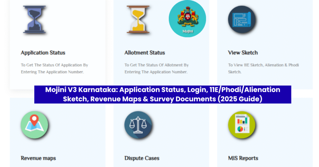
With Mojini V3, you can:
- ✅ Check Mojini application status online using the survey number
- ✅ Request a land survey digitally through the portal
- ✅ View and download land sketches including Form 11E, Alienation Sketch, and Phodi Sketch
- ✅ Access village (revenue) maps to check detailed land boundaries
- ✅ Track land allotment status and other government land records
Mojini V3 Portal Overview
Whether you want to verify land ownership, request a survey, or download 11E or Phodi sketches, the Mojini V3 Karnataka portal brings everything under one roof—with just a few clicks.
| Feature | Details |
|---|---|
| Launched by | Karnataka Government |
| Objective | Digitalize and simplify land records |
| Services Available | Land sketches, dispute reports, revenue maps, survey documents |
| Key Highlight | Transparent and real-time updates |
| Access Mode | Web portal & mobile app (Android & iOS) |
| Official Website | https://bhoomojini.karnataka.gov.in |
| Status Check | Via Application Number, Mobile Number, or Survey Numbe |
Aim of Mojini V3
The main goal of Mojini V3 is to digitize land records in Karnataka and make them accessible to everyone with just a few clicks.
Some of its core objectives include:
- Reducing land-related disputes by providing accurate and updated data.
- Saving time for both citizens and government departments.
- Offering real-time updates on land applications and ownership.
- Encouraging transparency and fraud prevention in land dealings.
How to Login to Mojini V3 Portal – Step-by-Step Guide
To access land services in Karnataka through the Mojini V3 portal, users must first log in using their credentials. Here’s a simple and clear guide:
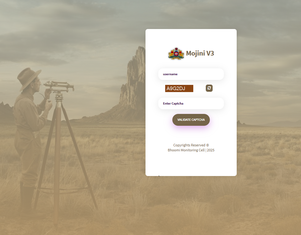
✅ Mojini V3 Login Process
- Visit the official Mojini V3 portal: https://bhoomojini.karnataka.gov.in
- Click the “Login” button located at the top-right corner of the homepage.
- Enter your username, password, and captcha code as shown.
- Click “Submit” to access your personalized Mojini dashboard.
💡 Note for New Users:
If you haven’t registered yet, you need to create a new account using your Aadhaar number and mobile number before logging in.
How to Check Mojini V3 Application Status Online
Tracking your land survey application status in Karnataka is easy through the Mojini V3 portal. Follow these steps to check real-time updates:
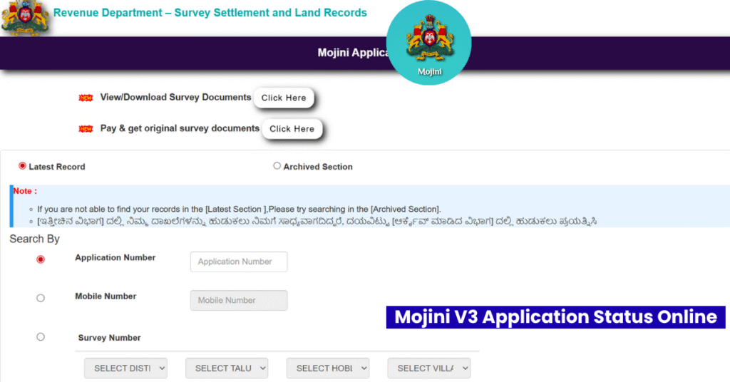
✅ Steps to Track Mojini V3 Application Status
- Visit the official Mojini portal: https://bhoomojini.karnataka.gov.in
- On the homepage, click on “Application Status” in the main menu.
- Choose your preferred method to search:
- Application Number
- Mobile Number
- Survey Number
- Enter the required details accurately.
- Click on “Check Status”.
The current status of your land application will appear on the screen.
How to View and Download 11E, Phodi & Alienation Sketches
You can easily view and download land sketches online through Mojini V3. These include the 11E sketch, Phodi sketch, and Alienation sketch used for various land-related approvals.
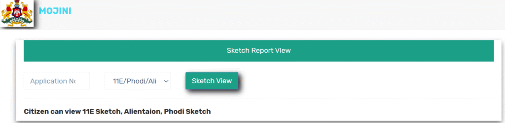
✅ Steps to View and Download Land Sketches:
- Go to the official Mojini V3 website.
- Click on “View Sketch” from the homepage or menu.
- Enter your Application Number.
- The relevant sketch (11E, Phodi, or Alienation) will be displayed.
- Click to download the sketch in PDF format.
How to View Village Maps / Revenue Maps on Mojini V3
Want to see detailed revenue maps for your village? Here’s how you can access and download village maps (revenue maps) using the Mojini portal:
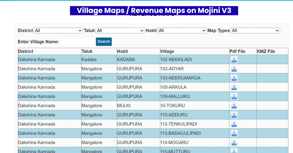
✅ Steps to View and Download Revenue Maps:
- Visit https://bhoomojini.karnataka.gov.in
- Click on the “Revenue Map” option from the homepage menu.
- Use the search feature to enter your village name.
- Once the map appears, click to download it in PDF format.
These maps show land boundaries, survey numbers, and official layouts for rural and urban areas.
How to Apply for Survey Documents on Mojini V3
Requesting survey documents through the Mojini V3 portal is a simple online process. It allows landowners and applicants in Karnataka to obtain official survey records without needing to visit government offices. Follow the steps below:
- Go to the official Mojini V3 portal at https://bhoomojini.karnataka.gov.in.
- Click on the “Request Survey Documents” option from the homepage menu.
- Enter your mobile number to begin the process.
- Complete the OTP verification sent to your mobile phone.
- Fill in the necessary details like survey number, location, and applicant name.
- Pay the applicable fee online using the available payment options.
- After successful submission, you can track your request through the Application Status section on the portal.
This online facility has made it easier and faster to obtain verified land survey documents, reducing the need for paperwork and delays.
How Mojini V3 Helps Citizens in Karnataka
The Mojini V3 portal has transformed how citizens manage land information in Karnataka. It plays a vital role in streamlining property-related processes and making land records more transparent and accessible.
Benefits of Using Mojini V3:
- Real-Time Land Records Access
Users can view updated land ownership details and survey sketches anytime, reducing the risk of fraudulent or duplicate transactions. - Easy Survey and Sketch Requests
The portal allows you to apply for land surveys, and view or download sketches like 11E, Phodi, and Alienation with just a few clicks. - Time-Saving and Convenient
What earlier required multiple visits to land revenue offices can now be done entirely online, saving both time and travel costs. - Improved Government Coordination
Mojini V3 helps government departments make faster decisions based on accurate and real-time land data, improving overall land administration efficiency.
This digital solution is a significant step toward transparent governance and has made land dealings more secure and reliable for the citizens of Karnataka.
Pro Tips to Avoid Delays & Rejections
- Keep your RTC, Sale Deed/Title Deed, Aadhaar, Tax Receipt handy
- Double-check survey numbers and application numbers
- Use the same mobile number across applications to track easily
- If something looks wrong, raise a grievance instead of ignoring it
- Save PDF copies of every sketch and map you download
Common Errors on Mojini V3 (And How To Fix Them)
“Invalid Application Number”
Re-check the number, verify digits, or use mobile number/survey number instead.
“Captcha Incorrect”
Refresh, re-enter slowly, or switch the browser.
“No Data Found”
Your record may still be syncing. Try again later or contact the Taluk Survey Office.
Login Not Working
Reset your password or re-register if it’s your first time.
Mojini V3 Mobile App for Android and iOS – Download & Features
The Mojini V3 mobile app brings the convenience of Karnataka’s official land services directly to your smartphone. Designed to mirror all the features of the Mojini web portal, the app allows users to easily access land records, survey sketches, and application tracking from anywhere, at any time.
📲 Key Features of the Mojini App:
- Request and track land survey applications
- View and download 11E, Phodi, and Alienation sketches
- Access village revenue maps
- Check application status instantly
- Available in Kannada and English for user-friendly navigation
📥 How to Download the Mojini V3 App:
- For Android Users:
Visit the Google Play Store, search for “Mojini V3”, and install the official app developed by the Revenue Department, Government of Karnataka. - For iPhone (iOS) Users:
Go to the Apple App Store, search “Mojini V3”, and download the verified app for iOS devices.
With multi-language support and a simplified interface, the Mojini V3 app ensures faster access to land-related services without needing a computer or visiting government offices.
Mojini V3 Contact Information – Helpline & Support
If you need assistance with land survey applications, sketch downloads, or any other services offered on the Mojini V3 Karnataka portal, you can reach out to the official support team for help.
📞 Mojini V3 Helpline & Support Contact Details
| Type | Details |
|---|---|
| Phone | 080-22221038 (Official Helpline Number) |
| sslrmojini.pmu@gmail.com (Support Email ID) |
Feel free to contact the Mojini support team for queries related to:
- Application status updates
- Land survey document requests
- Technical issues with the Mojini portal or mobile app
- Login or registration problems
Mojini | Mojini v3,Application status,Login,Sketch – Important FAQs
Q1. What is Mojini v3?
Mojini v3 is an online land survey portal in Karnataka that lets users apply for land sketch requests, track application status, and download survey reports easily.
Q2. How can I check Mojini application status online?
Visit mojini.karnataka.gov.in, click on ‘Application Status’, and enter your Survey or GSC number to check your status.
Q3. How do I login to Mojini v3 portal?
Go to the Mojini v3 website and click on the “Login” button. Enter your User ID, password, and captcha to access your dashboard.
Q4. Can I download land sketch from Mojini v3?
Yes, after approval, you can download your land sketch by entering your GSC number in the “Sketch Download” section on the Mojini portal.
Q5. Is Mojini v3 only for Karnataka residents?
Yes, Mojini v3 services are available only for landowners and applicants in Karnataka.
Q6. How long does it take for survey approval in Mojini?
Generally, it takes a few weeks for processing, but you can track live updates using your application number.
Q7. What is a GSC number in Mojini?
A GSC (Guarantee of Service to Citizens) number is a unique ID you get after applying for a survey. It’s needed to check status or download reports.
Q8. What services does Mojini v3 offer?
It offers sketch requests, status tracking, online payments, land survey reports, and sketch downloads — all in one platform.
Q9. Can I apply for a sketch request through mobile on Mojini?
Yes, Mojini v3 is mobile-friendly and works on smartphones for applying and tracking applications.
Q10. Is Mojini v3 linked with Bhoomi RTC?
Yes, Mojini integrates with Bhoomi RTC for updated land records and faster verification.